The Lava Bluffs Trail in Calaveras Big Trees State Park gives you a taste of the ancient and recent history of the area. Its course take you around a loop on the south east facing slope above the Stanislaus River and below the namesake Lava Bluffs.
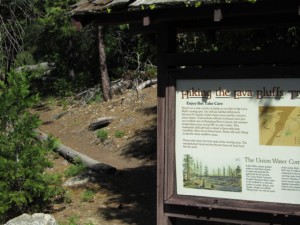
Along the South Grove road in Calaveras Big Trees State Park, about 4.7 miles from the entrance gate, you’ll see a small sign on the right hand side of the road pointing to the Lava Bluffs trail head. The trail head parking lot is right off the road. On the west side of the parking lot you’ll see a large information sign, and the trail starts right behind the sign.
There is a trail guide available at the trail head and I’d highly recommend that you pick one up. They’re only 50 cents, but well worth the dollar I spent for lack of change.
Before you start this trail, you should be aware of a few things…
- The trail stays entirely on a Southeast facing slope and there are sections of the trail that are completely exposed. So, be prepared for the heat and bring extra water.
- There are sections of the trail that are steep and covered with loose gravel so footing can be sketchy. This is not a trail for flip-flops!
- The exposed trail can be a very attractive sunning location for our cold blooded neighbors like rattle snakes. So, keep your eyes and ears open.
- There are a couple sections of the trail where Poison Oak seems very happy to live.
- There are several places where Mosquitoes can be pretty annoying.
That said, it’s a nice trail, not too long, and there’s some great history along the way.
The trail starts with a bit of a climb but the footing is good at the start. A little less than 0.2 miles in you come to your first of several of the somewhat steeper climbs. After climbing from 3900 feet at the trail head to a little over 4100 feet in just a little over a quarter mile, you drop back down to the beginning of the Lava Bluffs Loop Trail.
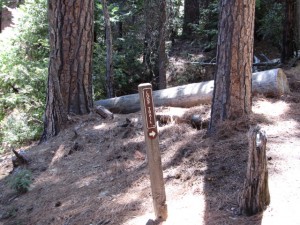
At the beginning of the loop there is a small trail sign with an arrow pointing to the right. However, I don’t see what harm it would do if you wanted to go straight here and do the loop backwards. It would be really surprising if there were enough people on the trail to cause a traffic jam but I suppose stranger things have happened.
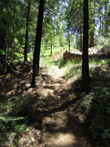
Soon after starting on the loop you’ll start climbing again for a little less than a quarter mile to an elevation of about 4200 feet. This section of the trail has some coverage and is quite pretty.
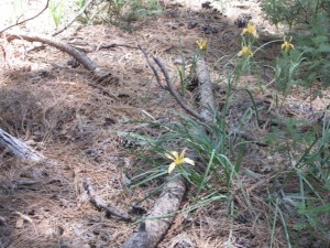
Along the way keep your eyes out for wildflowers. Along this section of trail, when I hiked it, there were quite a few Hartweg’s Iris in bloom.
After you reach the peak of this climb at 4200 feet, you come back down to a small annual stream crossing at a little over 4100 feet and about 0.7 miles from the trail head.
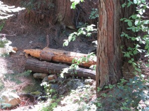
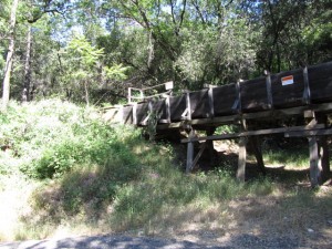
When I got here, in mid June, the crossing was an easy walk across. You can’t see it in the picture here, but on the other side of the logs shown crossing the steam bed there were some rocks that were easy to walk across.
After crossing the steam, you start back up hill again. Now, though, the trail is more exposed and you start getting into the gravel that has washed down from up around the lava bluffs. Watch your footing.
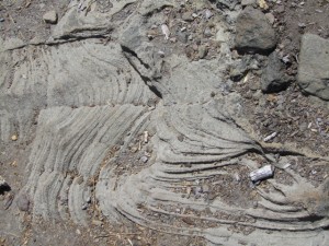
In this stretch, you often find yourself walking across ancient lava ash covered with a layer of gravel.  This layer of ash was laid down before the Sierra Nevada mountains that we know were pushed up to their current elevation.
It looks almost like water swept sand but this formation called tuff, is about 3o million years old and is quite… well, tough.
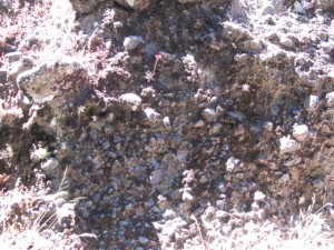
As you look up the slope next to you to the Northwest, you will begin to see layers of different sorts of rock including this tuff, layers of what appear to be a conglomerate of river rock and lava, and finally a solid lava top layer.
This was created by a series of events including lava flowing down ancient stream beds, mud flows, more lava, etc, etc over millions of years.
Later, after new steam beds were cut into this deep layered formation, more lava flowed and filled them. After the ancient volcanoes in the area became inactive, erosion gradually ate away at the landscape. First at the top layer of lava, and once through that, it gradually washed away layer after layer of the rocks below.
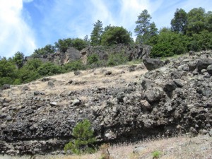
When you reach the next peak, at a little more than 4200 feet, and about 0.9 miles from the trail head, you’ll have a good view of the bluffs above you. To the South, down the Stanislaus River valley you should be able to also see the McKay Reservoir.
What make lava bluffs you see today are the remnants of the later lava flows that filled what were then stream and river beds. Because the lava was deeper there, than in surrounding areas, it has taken longer to erode and expose the softer material below. You can see the same sort of formations in many nearby locations, like Table Top Mountain.
A little further down the trail there is a spur trail that you can take to get a better view of the Lava Bluffs.
We’ve reached the tallest point of the hike now. For the next half mile or so we’ll be scrambling down over gravel strewn trail. Here again, watch you footing. We’re making our way down to a piece of history that is quite a bit more recent than the Lava Bluffs.
At a little over 1.4 miles from the trail head we will have worked our way down to a little under 4000 feet.
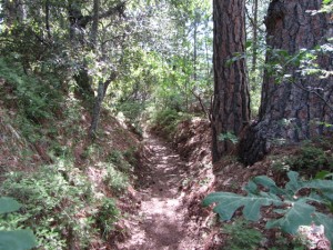
Here, we’ll take a sharp left turn onto a trail that looks like it’s going down the middle of a ditch. In fact, that’s exactly what it’s doing!
During the Gold Rush, the area in and around Murphys was a thriving placer gold mining location. The problem was that there were no reliable, year around water sources to use for washing the tertiary gravels that were being mined for gold. So, a few enterprising individuals formed the Union Water Company and bought or built a series of ditches and flumes that brought water from the Sourgrass on the Stanislaus River, all the way to Murphys and Angels Camp. It’s amazing to realize that they put all this in using picks, shovels, and mules back in the early 185os.
By the way, I’ve read that their undertaking was so successful that they managed to inundate Murphys and ended up blasting a gorge almost a mile long in order to drain it. You can still see parts of the old flume system used today to supply Angels Camp with water along Murphys Grade Road. This flume system has been burnt in forest fires and replaced several times over the years. The last time was in 2001.
The Lava Bluffs trail follows one of the ditch sections upstream for about a half mile. This is the most level section of the trail for obvious reasons.
At about 1.9 miles from the trail head, we’ll leave the ditch and start uphill again. In three tenths of a mile we’ll reach the next crest at about 4100 feet. About half way up the hill we’ll come to another small annual stream crossing. This is actually the same stream we crossed earlier, just a little further downstream. Here again, when I crossed it was a simple walk-across.
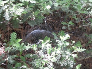
One of the marvels of the forest that I had never seen before hiking n Calaveras Big Trees State Park is a natural engineering wonder. This picture does not do it justice. The Sierra Dome Spider builds its web along with a complex set of tension lines such that it forms an inverted dome. It really is amazing when you look at it closely. Keep your eyes open for them.
From the last crest at 4100 feet there’s about six tenths of a mile to go back to the trail head. There’s some up and down but it’s generally down hill back to about 4000 feet.
Remember the rules of the park… no dogs or bicycles on the hiking trails. Don’t remove anything from the park.
Hope you get a chance to come out to the park and enjoy the hike!
For more information about the Union Water Company and history of the area you might want to pick up a copy of this book:
Joe,
Your description of the lava bluffs trail is ‘spot on’. My wife and I have hiked it many times in the spring, summer, and fall. The wildflowers can be spectacular if the winter rains are abundant. This spring the flowers were OK, but nothing like the spring of 2006. I have a few pictures from that year, but I’m not sure how to attach pictures on this site. Give me some instructions and I’ll attach them.
JohnM