I’m calling this a track rather than a trail because it really is a linked set of forest roads rather than a designated trail. Some of the road sections are inside Calaveras Big Trees State Park, and some are outside the park on Sierra Pacific Industries land. Some sections are maintained, and some are not. On the sections that are not maintained, you are bound to come across downed trees, brush, etc, that you’ll have to deal with one way or another.
The track goes up the east side of Beaver Creek for about 5 miles, then crosses over and comes back down the west side. Much of the first half of the trail is on a Railroad grade that was built (as far as I can tell) shortly after World War II by the Pickering Lumber Company who were logging giant Sugar Pine and other timber in the area. This grade, and our track, passes right next to the smallest National Forest, Calaveras Big Tree National Forest, which was set aside in 1945 to protect a stand of these old growth Sugar Pines. The national park is easy to miss as there are no signs, roads, trails, or improvements of any sort, and it is only 379 acres.
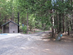
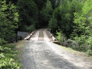
The track starts at the end of the Calaveras Big Trees State Park, South Grove road. There is a dirt fire road behind the locked gate at the end of the paved road. This fire trail follows the West side of Beaver creek upstream for about 0.6 miles until it crosses over to the east side on a solid vehicle bridge.
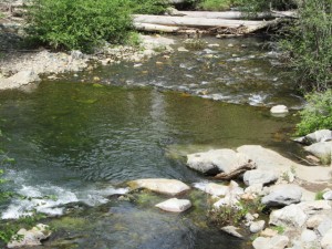
This location, where there is easy access to the creek and some places where the flow slows some, is a favorite for trout fishermen.
Once across the bridge, we go back downstream, now on the East side of Beaver Creek for a ways. Though we are going down stream, the trail still gradually picks up elevation as we begin to rise above the creek bed.
At a little less than a mile and a quarter from the start, and about six tenths of a mile from the bridge, we come across a trail crossing. Here, the Bradley Grove Trail crosses our path. In fact, though I did not confirm it on my exploratory hike, I believe that the Bradley Grove trail later meets up with the Rail Road Grade where we will soon find ourselves.
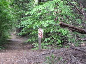
Remember that while in the State Park, dogs and bicycles are not allowed on single track foot paths, like the Bradley Grove Trail. So, if you’re on a bicycle and want to check out the trail, they’ve provided a locking station right at the junction. If you’ve brought your dog, keep on the road.
A little over a quarter mile from the Bradley Grove trail crossing, and a little less that a mile and a half from the start, you’ll see a very sharp left hand turn, almost a U turn. Take this to the left and it will put you on the old Railroad grade.
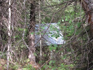
Just before you get to the Railroad Grade turn, you may see a water tank with a metal roof off to the right. If you see it, it means you’re getting really close.
If you happen to miss the sharp left turn onto the railroad grade, then in a few more yards you may notice a set of railroad ties set into the roadbed. If you come across these, you’ve gone a bit too far… turn around.
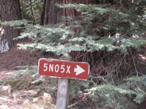
The railroad grade is marked as forest road 5N05X on some topo maps.
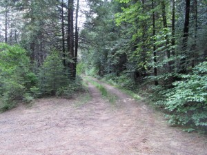
Here’s what the start of the railroad grade looks like (to the left) after you’ve taken the sharp left. It’s very inviting. You can tell right away that this is a road that does not see as much traffic as the one we’ve been on. Also, being a railroad grade, designed for hauling tons of timber out of the forest, it has a very gentle slope to it.
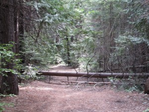
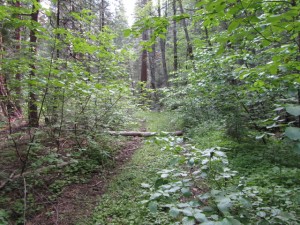
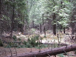
Once we make the turn and start on the Railroad grade, you’ll likely find that this section is not maintained. This results in a very lush, overgrown understory to the forest encroaching on the road and sometimes dominating it. It also means that it’s pretty likely that you’ll run into several fallen trees along the way. On my exploratory trek, some of these fallen trees were fairly small and easy to get over….
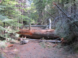
Some, not so easy…
Along the way, keep your eyes out along the sides of the path for old Railroad ties.
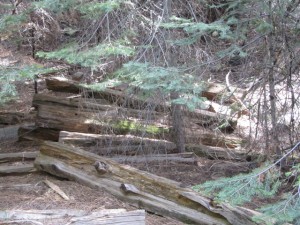
Sometimes there are just one or two buried in forest litter. In a few places there are large piles of the ties as you can see here. My guess is that at some point when they were done logging in the area, they pulled up the track to use elsewhere and moved the ties out of the way so they could use the road bed.
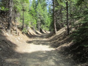
A little over four tents of a mile from the start of the Railroad grade, and about 1.9 miles from the start, you’ll come across one of several examples of where they made a cut through the hillside in order to maintain the gentle slope for the railroad. That’s a lot of dirt to have moved!
In another three tenths of a mile, just a little over 2 miles from the start, we come to a section of the track that is pretty densely overgrown. It’s quite beautiful anytime but even more so when the dogwoods are blooming in the spring or changing color in the fall. As beautiful as it is, remember that it is not maintained and there are lots of poked eye and tripped foot opportunities.
In this general vicinity keep your eyes open for redwoods. We’re near the Bradley Grove here and you should see quite a few young Redwoods in the area.
In another seven tenths of a mile, at about 2.9 miles from the start, we come to what I suppose is the edge of the park, and a locked gate. There’s no barbed wire, and no signs suggesting otherwise, so it’s easy to walk around the side of the gate.
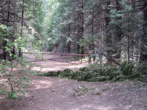
About a quarter mile down the road we run into a cattle gate which includes a ramshackle barbwire gate across a steel cattle guard. If you walk around to the right side of the gate you’ll see that it is held in place by a wire loop at the top. Lift the wire loop off the top and you can get through. Just make sure you put it back so cattle don’t get into the park!!!
Now, you are in a different environment! The path we’re taking is now accessible by us as well as range cattle, Jeeps, Motorcycles, and… Logging Trucks! Keep your eyes and ears open and stay out of the middle of the road.
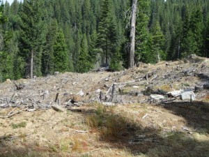
About 0.3 miles from the barbwire cattle gate you’ll come around a bend to the left and clear evidence that you’re outside of the park. This is one of several clear cut areas that we’ll pass over the next few miles. If you take a look at the map above with the satellite option, you’ll be able to see the patchwork of clear cut sections all over Sierra Pacific Industries land.
In another 0.3 miles further down the road, and 3.74 miles from the parking area, we come across a forest road that branches off to the left, and appears to be headed down toward Beaver Creek. We’ll stay keep going on 5N05X, the railroad grade. We come to another junction in a bit less than a quarter mile, this time with a road leading off to the right. Here again, we continue on the railroad grade, which itself bends to the right at this point, though more gently… like a railroad grade would do. This junction is also not shown on some topo maps.
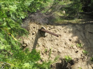
In a little less than a quarter mile from the last junction and about 4.2 miles from the parking area, we come to where there must have been a small trestle crossing Grizzly creek. If you make your way over toward Beaver Creek at this point you may catch a glimpse of an piece of the old track sticking out of the bank on the other side of the creek. I could see no other remnants of the train crossing.
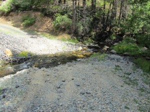
Our track takes us off the railroad grade for a short distance to a walk-across crossing of Grizzly creek. After crossing the creek, we double back and find ourselves near the other side of the old railroad crossing where we rejoin the grade. Here again, if you make your way down near the bank of Beaver Creek, you may be able to get a closer look at the piece of old railroad track sticking out of the bank.
It’s pretty obvious when we rejoin the the old railroad grade. One of the clues is how the road was cut through small rises in the terrain in order to maintain the shallow grade. Whenever we leave the grade the track tends to follow the terrain more closely.
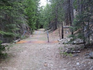
A little less than a half mile from the Grizzly Creek crossing, and about 4.7 miles from the parking area we pass through an old, abandoned cattle guard. The fence is down and the grate is completely filled with dirt so it’s not going to stop many cows… or us.
A little less than four tenths of a mile from the abandoned cattle guard, the slope of the road becomes noticeably steeper. I didn’t notice where the grade took off from 5N05X, but from here on, we’re no longer on the old railroad grade.
About a 6 tenths of a mile from the old cattle guard, we come across a junction with an unmarked road off to the right. We’ll keep going on 5N05X for just another tenth of a mile, where we’ve come to a junction with forest route 5N03. There is a sign at this junction indicating that we’ve been on 5N05X.
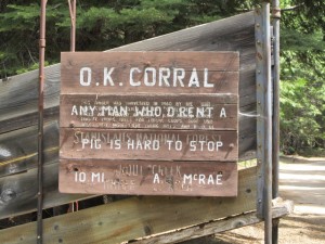
We’re going to continue in a Northeasterly direction on 5N03, and go past, of all things, what is indicated to be the O. K. Corral. It’s an unexpected site out here in the middle of nowhere!
We’re now about 5.4 miles from the parking area.
Just a bit further down the road, we come across a sign indicating that we’re now on forest route 5N03.
About 0.28 miles from the O.K. Corral, where we joined 5N03, we come to a signed junction with 5N02. 5N02 is a major forest road that goes all the way from Boards Crossing Road in Dorrington, over to Beardsley Lake near Highway 108. We’ll cover this rather long, bumpy, dusty road trip in another article soon. 5N02 is also known as Hell’s Half Acre Road.
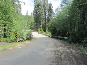
We’re going to go left on 5N02. In about a tenth of a mile, at a little over 5.8 miles from the parking area, we’re going to cross a good, solid bridge to the west side of Beaver Creek. There is relatively easy access to the creek on the west side of the bridge both up and down stream. It looks like a great fishing spot to me.
Once we cross the bridge, we’re going to bear left, leaving 5N02 almost immediately after the bridge , until we’re headed generally Southwest, following the course of Beaver Creek. On the East side of the creek we had been fairly close to the level of the creek bed. On the West side we find ourselves rising above it as it cuts lower as it goes downstream and we gain a bit of altitude.
About a half mile from the Bridge, and 6.34 miles from the parking area, we come to a left hand turn which we’ll take onto Forest Route 5N78. This forest road descends gradually, at about the same rate as Beaver Creek in a generally Southwest direction. We descend steadily for a little over a mile where we come to a junction with a road that goes off to the left. At this point we’ll continue on, now starting to go up hill. We’ve now gone a little over 7.4 miles from the parking area.
We continue going up hill for another 3/4 mile where we’ll come to a more level stretch and a fork in the road. We’re going to bear left, following the stream bed although we are now quite a ways above it. The next four tenths of a mile is fairly level. After the fairly level section we’re going to be headed down hill all the way back to the parking area. On the way down, you may notice a couple roads that take off from our track that have had ridges bulldozed into them to discourage vehicle traffic. Don’t take any of these, stay on the main course.
About 3.2 miles from the bridge over Beaver Creek, and 9 miles from the beginning of our trek, you should come to a locked gate marking the boundary back into Calaveras Big Trees State Park. On the positive side… no more vehicles, no more cows. On the negative side… no more maintenance! When I took the path, I came across a section here with lots of down trees.
Slightly less than a mile from the gate back into the park, we come to a fork in the road where we’ll bear right. At this point, either fork will take is back to the trail near where we started, but going right here is just a little quicker. In about a quarter mile we’ll rejoin the trail we started on within sight of the parking area.
I have taken this path now by foot and mountain bike. I have to say that it is much more fun on the mountain bike. Other than dealing with down trees, gates, and a few overgrown areas, the path is clear, well graded fire trails and the assents are not too steep. For a walking trail it’s a bit long, a bit exposed and dusty, and not as scenic as many other hiking trails in the vicinity.
As I said at the beginning, this is not a marked or maintained trail. You should have a map and/or GPS and have figured out where the track goes if you want to try it. Use at your own risk!
Enjoy the outdoors!
joe

I rode this trail last Friday. I hadn’t ridden my bike in a year and the trail was perfect for me – long enough to get a workout but no long climbs or rough terrain. You do have to be able to lift your bike to chest height to get over a couple of obsticals. Good news since your post – the downed trees after you cross back into the park at the end of the circuit have all been cut up and stacked neatly on the side of the road.
DavidB
Good news, David! Thanks for the update.
joe