Hi everybody,
This loop trail in Calaveras Big Trees State Park takes us up and around Big Trees Creek and the South Grove. Unlike the Beaver Creek Loop, this path stays entirely within the park boundaries and stays on fire roads that are behind locked gates and well maintained. At a little over 11 miles, with a couple moderate climbs, this trail is great for mountain bikes, good for trail running, but perhaps a bit long for hiking. However, again unlike the Beaver Creek Loop, this path is mostly under the cover of the forest with fewer completely exposed areas. 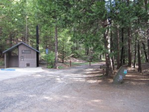
We start the trail at the locked gate which is at the end of Big Trees Parkway (the road to the South Grove). From there, we follow the same path that we did for the Beaver Creek Loop up to the point where the Rail Road Grade takes off to the left. So from the locked gate, we go about 1/2 mile upstream on the West side of Beaver Creek where we cross it on a good bridge. 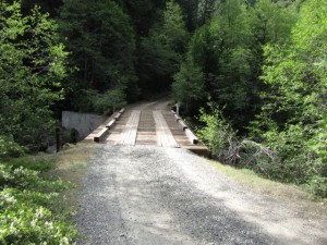 We’re now going to be heading down stream on the east side of Beaver Creek, but our path goes gently up hill rather than following the stream bed. After another half mile or so, we come to where the Bradley Grove trail crosses our path. The Bradley Grove trail is a footpath only so don’t take your Dog or Bicycle off the road to explore. Dogs and Bicycles are only allowed in campgrounds, or on paved roads, and fire trails in the Park. There is a place to lock your bike at the junction in case you want to go have a look.
A little more than a quarter mile further up the road we come to where we turned sharply left for the Beaver Creek Loop. At this point, about 1.4 miles into our journey, we’ll stay on the main road and go straight this time. In just a few more yards we’ll come fork in the road and take it (I love that line!). This is where the actual loop part of our path begins and ends. We’ll be going left, counter clockwise around Big Trees Creek and the South Grove. You could go the other way, but if you’re going on a mountain bike my personal opinion is that the counter clockwise direction is better because you don’t have as many gravely uphill sections to deal with.
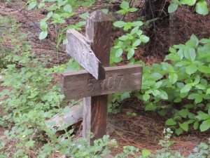
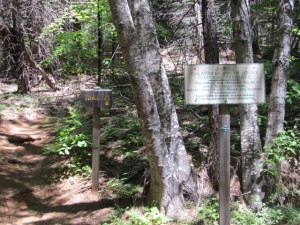
There is a sign at this fork indicating that the path to the right is 5N07, and the path to the left is 5N36. However, recent topo maps, such as those from MyTopo.com, indicate that the path to the left is actually 5N45. If you’ve taken the Beaver Creek Loop path already, you’ll no doubt recognize that 5N07, off to the right, is a continuation of the old railroad grade that used to go through the forest.
After taking the left fork (not 5N07), we’ll very shortly run into one of the steeper uphill sections of or path. A bit further on and the steepness of the slope decreases but we’ll continue generally up hill until we reach the five mile mark in our trek.
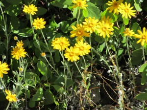
When we’ve gone almost 1.7 miles from the start, we find ourselves in a section of the forest that appears to have gone through a forest fire in the not too distant past. It appears that either the fire or the fire fighters, or both have thinned the forest and the understory in this area. As a result, this area is also a great place to find a wide variety of wildflowers. In the resources section below I’ve shown a great book to help identify many of the wildflowers you’ll come across as well as most of the other plants, trees, mammals, fish, insects, and spiders you’ll come across in the Sierras.
At about 4.3 miles from the start we come to another one of the areas in the park where its volcanic past is evident. Much like what was described in the Lava Bluffs Trail article, you’ll see patches of lava and ash mixed with native rock. There’s a great description of the geologic history of the Sierras in the other resource I have listed below.
After having gone about 4.6 miles, we come, finally, to the highest elevation of our journey. At this point, we are almost directly above the start of Big Trees Creek which flows South West from here. We’ve been following its path upstream since shortly after taking the fork onto 5N45 (or 5N36???). Though we’ve been following its path, the creek is small enough, and we’ve been far enough from it that we’ve yet to see or hear any evidence of it. So, don’t count on the creek to replenish your water. Bring what you need for you and your dogs if they’ve come along.
At the peak here our path will take use around a bend to the right and we’ll start going down hill. Right at the peak you may notice a barbed wire gate off to the left, near the main path. Starting here, for the next four miles or so, we’ll be skirting the southern boundary of the State Park. Keep and eye on your left and you’ll often catch a glimpse of the barbed wire fence intended to keep free range cattle out of the park. Keep your ears open and you may hear the cow bells. You may even run into cattle inside the park if someone has negligently left one of the gates open. If that happens, make sure you go by the Park’s visitor center and let them know where you saw the cattle.
A short distance from the peak we come to the first of several fairly steep, gravel covered sections going down hill. For me personally, these are the reason why I like taking the trail in this counter clockwise direction, particularly on my mountain bike. I’d much prefer to deal with gravel going downhill rather than up hill.
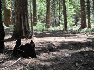
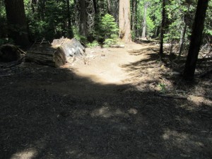
At about 6.3 miles from the start, there is an unmarked trail that goes off to the right. This trail is obvious and appears to have been built and maintained but does not show up on either the park map or topo maps… the only mystery of the day… However, we’re staying on our fire trail, down hill, to the South West. In another quarter mile we run into another unmarked trail that also looks purposely built and maintained. Here again the trail does not show up on either the park map or topo maps.
At about 7 miles from the start we come across another fire trail going South, off to our left. We’re going to go on past it though since it (5N20) just leads outside the park and is no doubt fenced off. In just a little less than another mile, at about 8 miles from the start, we come to another fire trail leading off to the left. Here again, we’ll keep to our course bending a bit to the right since this road (5N36 I believe) also leads outside the park and is probably fenced off.
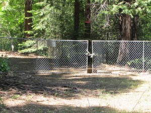
In another four tenths of a mile, at 8.5 miles from the start, our course takes a sharp right. This is the junction of 5N07 and 5N45 that we’ve been following up to now since taking the fork near the beginning. There’s a chain link fence across 5N07 to the the left, which is also the Park boundary. So, our course is to the right, now on 5N07.
At a little over 9 miles from the start we come across a junction with another road that goes off to the left. It also appears that at one time it crossed and went off to the right as well but that direction has not been maintained. This road does not show up on topo maps so I can’t tell you what it is or where it goes. Fortunately, our path is pretty obvious and we’re going to stay on it.
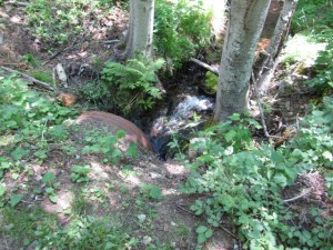
Just a bit further down 5N07, at about 9.2 miles from the start, we finally get our first, and only glimpse of Big Trees Creek. While the Big Trees are impressive, the creek is not. If flows under our path in an unflattering corrugated steel culvert.
Very shortly after leaving Big Trees Creek behind, we come to where the South Grove Trail crosses 5N07. The trail is clearly marked, but too often, people who are going out to the South Grove become momentarily confused by this junction and may want to follow you rather than pay attention to the trail signs. If this happens, please get them turned around and back on the trail.
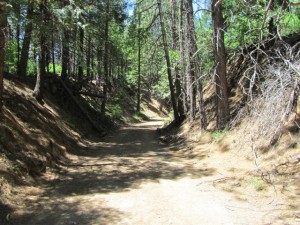
Soon after the South Grove trail crossing, at about 9.3 miles from the start, our path, 5N07, starts to follow the old railroad grade that was uses to haul lumber through the forest. Where we join the grade you can see an unmaintained section of it going off to the right as our path follows it to the left.  Being an old railroad grade, the slope is gentle and you can see evidence of the tremendous effort that was made to keep it that way. We’ll follow the grade for about seven tenths of a mile as it gradually turns us in a North Easterly direction and takes us all the way back to the fork where we started our loop.
Coming from this direction, if you look across the road we originally came in on, you’ll be able to clearly see how the railroad grade continues on the other side of the road. For a description of that path read the article “Beaver Creek Loop”.
We’re now back in familiar territory, on the road that we originally came in on, at the form marked with the sign for 5N07 and 5N36. So, we’ll turn left toward Beaver Creek, and follow the path about 1.4 miles back to the parking area.
I have hiked and mountain biked this path. Both were enjoyable, but I thought it was a better for mountain biking than for hiking, mostly due to the distance. If you’re going to hike over eleven miles, there are some much more scenic trails in the area.
Recommended resources:
Enjoy,
joe
I would love to find a great book of trails and maps for my husband for mountain bike exploration. Any suggestions. Love everything you have contributed.
I’d suggest talking to Eric down at Mountain Pedaler in Angels Camp. He’s an avid mountain bike rider in the area.