This route makes a loop through a lot of wide open ranch land in North Eastern Stanislaus County and takes you along the Stanislaus River between the town of Knights Ferry, and Kerr Park.
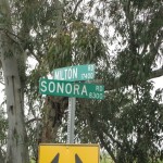
While we could start this loop from anywhere along its course, and one could make a good argument for starting and ending in the community of Knights Ferry, we’re going to start at the junction of Milton Rd and Sonora Road (‘A’ on the map). We get there by turning South off of Highway four onto Milton Road and driving about three and a half miles. There’s a wide gravel shoulder on Sonora Road at the junction big enough for a few cars to park.
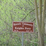
We’re going to do the loop clockwise for no particular reason. I’ve seen people do it counterclockwise also. So, we are going to head straight down Sonora Road. This first leg is the easiest to follow as we’re going to just stay on Sonora Road for almost the next 12 miles until we go through the town of Knights Ferry to the Stanislaus Recreation Area / Picnic area just outside of town.
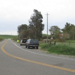
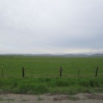
Most of Sonora Road goes through cattle country with wide expansive views, and in the spring time lush green low rolling hills for as far as you can see. You won’t have to look hard for the cattle, they’re everywhere along this stretch of road. If you keep your eyes open though you might catch a family or two of groundhogs along the way. In the first 8 miles, we climb about 140 feet to just under 300 feet in elevation. We then drop down by about 60 feet in the next third of a mile and bounce back up 123 feet in less than three quarters of a mile. Now into the course a little over 9 miles, we are at the highest point we’ll see today at about 358 feet in elevation. After reaching this peak (loosely defined), we descend about 120 feet in a little over a mile. Now, just under ten and a third miles into the course, we reach the junction of Sonora Road and Orange Blossom Road. If you wanted to shorten the loop by a few miles you could turn right on Orange Blossom Road, but then you would also miss out on seeing the quaint community of Knghts Ferry which we’ll be coming to shortly
At the junction with Orange Blossom, we turned left at the stop sign to stay on Sonora Road and regain about 60 feet over the next two thirds of a mile. At just under 11 miles into the the course, we begin our descent into the Stanislaus river basin and the community of Knights Ferry. This descent is only about 128 feet over a half mile.
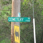
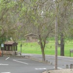
If you don’t care to stop or slow down on your ride, you could just turn right at Cemetery Street (‘C’ on the map), just before you come into “down town” Knights Ferry (also loosely defined). However, it’s worth taking the short ride through town and maybe taking a short break at the Knights Ferry Stanislaus River Recreation Area just on the other side of town (‘B’ on the map).  There are porta-potties, and a picnic area at the recreation area and according to a sign we saw there, they apparently also have drinking water though I did not take the time to scout it out.
We’ve come just under twelve miles when we reach the Recreation Area just outside Knights Ferry. By turning around and heading back the way we came, we could cut the total distance down by about 14 miles, to about 24 miles. However, we’re going to continue on the loop.
From the recreation area, we retrace our route back about a half mile, through town, to Cemetery Road (‘C’ on the map) and turn left up the short steep hill. On Cemetery, we gain about 140 feet in under a third of a mile. We’re going to turn at the first left onto Frymire Road (‘D’ on the map). However, you might want to take a short detour continuing on the now flat Cemetery road keeping your eyes open to the left. You just might spot the Camel or Zeedonk (Zeebra + Donkey = odd) or some other exotic creature that call this ranch home. This also gives you a little break before we climb a little more on Frymire.
If you wanted, you could just continue a bit more on Cemetery road and then turn left on Morrision. We’re going to turn from Cemetary onto Frymier though and after a short assent and a gradual decent, we’ll catch up with Morrison after about 1.7 miles.
At the junction of Frymire and Morrison (‘E’ on the map), we’ve now come about 14.4 miles from the start. We’re going to go left on Morrison, heading due West for a while before it turns North just before the intersection with Orange Blossom Road. We’re only on Morrison on a shallow descent for just over eight tenths of a mile. Since getting on Frymire, we’ve been following the course of the Stanislaus River pretty closely and will continue to do so for several miles to come. There are several river access recreation areas along the way similar to the one outside Knights Ferry.
At the junction of Frymire and Orange Blossom Road (‘F’ on the map) we turn left and continue to follow the course of the Stanislaus river for about nine tenths of a mile before turning right, up Horseshoe Road (‘G’ on the map). We could skip this little detour and continue on Orange Blossom, but the extra couple miles helps get us a bit closer to 4o miles total (actually 38.2). So, we take the easy 2.4 mile “horseshoe” and find ourselves back to Orange Blossom road (‘H’ on the map) where we’ll turn right and continue once more to follow the course of the Stanislaus River. At this junction, we’ve come just over 18.5 miles from the beginning.
Back on Orange Blossom now, we continue 2.5 miles until we come to Rodden Road. We continue to follow the Stanislaus by turning Right on Rodden Road (‘I’ on the map). Just off to our left we’ll see the rather large and inviting “Orange Blossom Recreation Area”, yet another river access park.
We continue on Rodden Road, staying along the northern bank of the Stanislaus River for a little over 2.9 miles. At this point, almost 24 miles into our journey, Rodden takes an uphill turn toward the North, and away from the river bed. After another half mile, Rodden Road turns back generally Westward. We continue on Rodden Road for about 1.4 miles where it ends at a T-junction with Twenty Eight Mile Road (‘J’ on the map). We’re now about 28.8 miles from the beginning.
We’re going to turn right on Twenty Eight Mile Road which starts out heading us due North. A little over 2.8 miles on Twenty Eight Mile Road, we come to the cross street, Dorsey Road, and the beginning of the Woodward Reservoir Stanislaus County Park which will be on our left as we cross over Dorsey. We continue on Twenty Eight Mile Road which soon begins to take turns to the East, North East, North, West, etc, as it skirts the boundary of the Reservoir.
About three miles from crossing over Dorsey, we come to a junction with Eastman Road (‘K’ on the map). From here, Twenty Eight Mile Road continues on straight, to the North, and would get us back to the beginning more quickly, but it also turns into a dirt road here. So we’re going to take Easman Road West, to the left.
Eastman Road, like Twenty Eight Mile Road, skirts the reservoir park boundary, but on the Northern edge. We follow Eastman generally Westward for about 2.2 miles where it ends at a T-junction with Twenty Six Mile Road (‘L’ on the map). We’ve now come a little over thirty three and a third miles from the start. We take Twenty Six Mile Road, right, to the North. About 2 miles after we join Twenty Six Mile Road, the road name changes (though there is no sign that I saw) to East Sonora Road (‘M’ on the map). From here, the road turns toward the East and in another 1.9 miles, takes us back to the junction of Sonora Road and Milton Road where we started (‘A’ on the map).
I have yet to personally ride this route on my bicycle, but other than the short steep climb up Cemetery road, the climbs seemed relatively gentle. The traffic was light to non-existent for most of the route with the exception of “down town” Knights Ferry and the stretch of Twenty Six Mile Road and East Sonora Road, but even those did not seem too dicey.
If you’ve ridden the route, or if you catch any mistakes I’ve made in this description, please feel free to leave your comments!
joe
